Stage 25 – Rabanal del Camino – Acebo
Total Distance – 14.8 km
Adjusted for Climb – 17.0 km (accrued ascent 400 m = 2.0 km)
High Point: La Cruz de Ferro at 1,505 m (4,940 feet)
CLICK ON THE PICTURES TO ENLARGE TO FULL-SIZE

Manuel, the owner of the wonderful Casa Rural A Cruz De Ferro with myself and Sue

Myself, Manuel and his wife Miriam
Having been fortified by the great hospitality of Manuel and Miriam our gracious hosts at the Casa Rural A Cruz De Ferro, Sue and I were ready to tackle the mountain pass of Irago that Brierly called,
…the highest point of our whole journey
Brierly was referring to the puerta Irago where la Cruz de Ferro is to been seen and I felt prepared and looked forward to the climb. With this in mind Sue and I made our way through the outskirts of Rabanal.

Cyclist making his way through Rabanal

Watering area just outside Rabanal

Monument outside of Rabanal
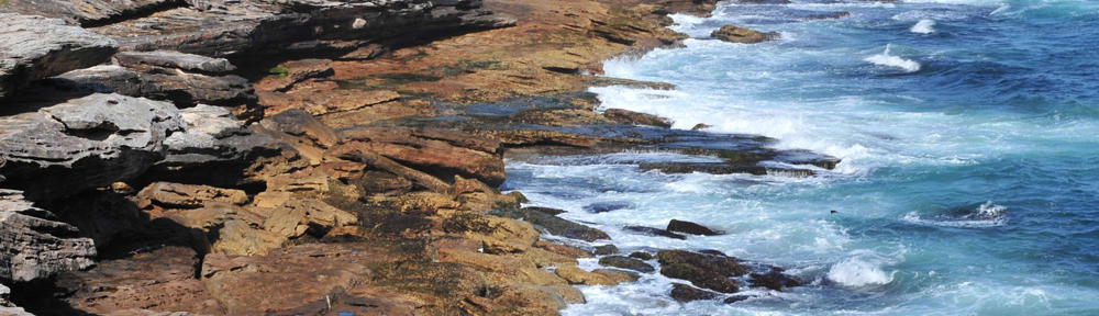
Soon we were making our way up the trail with views of the río Turienzo valley.

The terrain ahead

Walker, cyclist and Sue ahead on the trail

Beautiful watering trough that we saw north of Rabanal

Detail of the watering trough
Both Sue and I were in good spirits as we tackled the gradual but steady climb. For the first 5 kilometers we would be climbing a little over 250 meters over a trail that was rocky in some places. Luckily for us the weather was beautiful and even though I had prepared for it to be cold by buying a black thermal shirt while in Astorga it wasn’t as cold as I expected it to be.

Sue enjoying the hike

Me on the trail

Posing with a local who made fruit available to us poor peregrinos

Sue leading the way!

Taking pictures of the local flowers
 We were steadily approaching the village of Foncebadón and I was thinking of the passage in Gitlitz’s and Davidson’s The Pilgrimage Road to Santiago: The Complete Cultural Handbook that quoted a warning from 1790,
The nature of the landscape is extremely rough and fearsome, and from nearly the first of September until the end of May the pass is closed, and the neighboring villages put up cairns to mark the route, and if this is insufficient, they dedicate themselves to guide, accompany, house and thaw out the poor pilgrims who come and go from Galicia.
I could well imagine how different out journey would have been in the throes of winter and I was glad that I did not have to face what the “poor pilgrims who come and go from Galicia” faced in 1790!

The Landscape

English peregrino walking into Foncebadón

The village of Foncebadón
Foncebadón, semi-abandoned but rebounding today, has been a village for over 2,000 years and in its Roman past was an important place in the machinery of the Empire in that the village and the mountain pass through the Irago mountains served as an artery connecting Rome and the crucial wheat lands of the Castilian Meseta with the gold mines of Bierzo. In the houses that are being renovated you notice that their construction makes heavy use of local slate. Roofs are covered in slate or thatch and the chimneys are enclosed with slate. The walls of the ancient buildings are capped with flat horizontal stones that keep out rain, snow and dew from penetrating the walls or otherwise they would freeze and crack open.

Marcos, ex-paratrooper and my gracious host at La Taberna de Gaia in Foncebadón

His campaign flag
It makes very good sense to stop while in Foncebadón (also it’s the only place to stop for food) because you need to gather up your strength before the rest of the climb and not to mention the steep and dangerous descent that awaits you. We had the good fortune to have met Marcos who was our host at La Taberna de Gaia. This mountain-side tavern was a refreshing stop and I enjoyed conversing with Marcos about his days as a paratrooper and also about his son who is a player in the Barcelona system. As a Real Madrid supporter I was met with the expected ribbing but I managed to give as good as I got. It was all in great fun and I told Marcos that I expected to see his son play professionally one day in the Santiago Bernabeu stadium. He made a look of horror as I said this but recovered when I told him that it was as a Barcelona and not a Madrid player that I expected to see him. Soon, we had to get on our way because we still had quite a way to go.

Views from Foncebadón


The road leading up from Foncebadón.


Foncebadón from up higher

More heights await us ahead

Sue moving on ahead
The famous La Cruz de Ferro is just 2 kilometers above Foncebadón and very soon we were there. This cross is to my way of thinking both a monument to the mountain pass, reminding you that you are now at 1,504 meters (4,934 feet) of altitude, and a monument to the Pilgrimage. It is here at the top of the immense rock-pile that peregrinos leave a rock, either one that they’ve brought from home or one that they’ve picked up at the start of their journey as a symbol of their journey or as an act of contrition. This simple act also has a precedent in history be it the pre-Roman Celts (the Gaelic for these piles of rock is the word cairns) or Roman travelers who used them to pay homage to the God Mercury. It was here that the hermit Gaucelmo decided to top a rock-pile with a cross and turn the tables on a pagan act.

La Cruz de Ferro

Sue leaving her stone at the top of the rockpile. Notice the hats, ribbons, notes that peregrinos have left stapled to the pole
A short while after our visit to La Cruz de Ferro we met a young American peregrino named Chris. Sue was intrigued by the fact that he and I had the two smallest backpacks she had ever see on the Camino. She made sure to record the fact.

Dueling backpacks

Chris moving ahead

Chris contemplating the way ahead

Another fallen peregrina
While walking with Sue and Chris we started discussing the next village on our route. It was a place named Manjarín and it was another of those abandoned villages one sees from time to time on the Camino. That one had a strange twist in that there was a communal albergue in a renovated house, with very basic facilities, there that boasted “the last Templar”. Chris was very keen on staying there and I definitely was not because it was too early in the stage and it seemed too “primitive” for my tastes.

Chris heading toward Manjarín.

Manjarín and its communal albergue

Manjarín
Sue and I left an excited Chris in Manjarín and proceeded on our way through a wonderful mountain trail. Soon we were at a fruit stand and there we met the owner of the fruit stand. Her name was Siehoa and she was originally from the Basque country. She told me that she was hiking in the area and that she fell in love with it and never returned home. She had renovated a house in Manjarín and she lived there now.

The English peregrino taking a picture of the fruit stand

Siehoa and me
After leaving the fruit stand we were heading for the military observation post which marked the highest elevation of the whole route. From that point on the route was dangerously steep and full of large-sized rocks that made for a difficult descent. I can tell you that I found it to be the most difficult descent (400 meters in 2 km!) of the whole Camino!! I had to be very deliberate in where I was steeping in order to avoid twisting my ankle. Because of the difficult nature of the descent we made an executive decision to stop for the evening at Acebo. It was a good decision because we could go no further. Tired but happy we settled in early in the one-street town of Acebo.

Sue again leading the way! You can see the military observation post at the top of the mountain at 1.535 meters (5.036 feet!)

The trail


The nuclear power station at the left of the picture


Peregrinos making good time

The trail in front of us was very steep and full of rocks

Acebo, our destination

The Casa Rural where we stayed

The view from Acebo
